SUPER CONTINENTS
A Super continent is a continuous land mass made up of several continents. The Earth's outer shell is broken up into several plates called Tectonic plates.
Millions of years ago, the movement of these plates over the Earth's rocky shell or mantle, brought land masses into collision with each other.
PANGEA
The collision was so violent that mountains were formed as the existing continents smashed together to form one giant super continent. About 300 million years ago, during the time of the dinosaurs, Earth didn't have seven continents, but instead, one massive super continent called Pangea, which was surrounded by a single ocean called Panthalassa.
Later, Pangea started to break apart into two super continents.
They were - GONDWANA and LAURASIA.
More mountains were formed, and parts of the continents that had been inland were now on the coast, and this changed the climate in many areas.
GONDWANA
Gondwana was an ancient super continent that was formed when Pangea broke up. About 280 million to 230 million years ago, Pangea started to split.
Magma from below the Earth's crust began pushing upward, creating a fissure between what would become AFRICA, SOUTH AMERICA, and NORTH AMERICA.
As part of this process, Pangea cracked into a northernmost and southernmost super continent. The northern landmass came to be known as Lauraisa. The southern land mass headed southward after the split. The super continent was Gondwana. Gondwana stretched from the South pole to the Equator.
However, the world was warmer then , and the climate was fairly mild. Gondwana had vast forests of temperate tress, with many dinosaurs, birds and reptiles running through the undergrowth.
Gondwana itself eventually split into the land masses we recognize today - AFRICA, SOUTH AMERICA , AUSTRALIA, ANTARCTICA, THE INDIAN SUBCONTINENT, and the ARABIAN PENINSULA.
LAURASIA
Laurasia is the name given to the largely northern super continent that is thought to have formed after the split of the Pangean super continent. It included most of today's continents in the northern hemisphere.
In fact, Lauraisa comprised of what later became North America and Eurasia, except for India. The super continent was dominated by conifers as well as other seed plants and ferns.
At first, Laurasia was largely located in equatorial latitudes. Later, it began to break up, with North China and Siberia drifting into latitudes further north.The name Laurasia is a combination of the names of Laurentia and Eurasia.
PANTHALASSA
Panthalassa was the name given to the vast ocean that surrounded Pangea when that super continent was in existence.
In fact, the word Panthalassa means 'all the seas' . Currents in the Panthalassa would have been simple and slow, and the Earth's climate was, in all likelihood, warmer than today.
When Pangea broke up into Gondwana and Lauraisa. the Tethys seaway was formed. This sea seperated Gondwana from Laurasia. It became the home of many unique marine reptiles, mostly coastal an shallow water dwellers.
The breakup of Pangea also created the different oceans as we know them today - the PACIFIC, ATLANTIC, ARCTIC, INDIAN OCEAN, and SOUTHERN OCEANS.
WHAT IS CONTINENTAL DRIFT?
The term continental drift refers to a theory regarding the movements of continents that was first suggested by Abraham Ortelius in 1596.
However, it was developed into a proper theory only in 1912 by Alfred Wegener.
According to this theory, the world was made up of a single continent millions and millions of years ago. That continent eventually separated and drifted apart, forming the seven continents that we have today. Wegener stated that the continents consist of lighter rocks that rest on the heavier material of the Earth's crust - similar to the manner in which icebergs float on water.
He also believed that the relative positions of the continents are not rigidly fixed but are slowly moving - at a rate of about 1 yard per century.
WHAT IS PLATE TECHTONICS ?
Deep beneath the surface of the Earth, heat rises from the core, which is the center of the Earth, through the mantle, which is the next, and then it reaches the crust. It comes up slowly, but it actually moves the mantle.
The mantle rises beneath the Earth's crust before it spreads sideways, and then cools again. This slow, but constant movement of the mantle divides the Earth's crust into plates known as tectonic plates.
Most of the Earth is covered by 7 major plates and another eight or so minor plates. The seven major plates are the African, Antarctic, Eurasian, North American, South American, India - Australian, and the Pacific plates.
All this happens over millions of years, and it's called continental drift. The Earth only moves about 15 cm a year. The study of the movement of the plates on the Earth's crust is called plate tectonics.
WHAT IS THE PROOF OF CONTINENTAL DRIFT ?
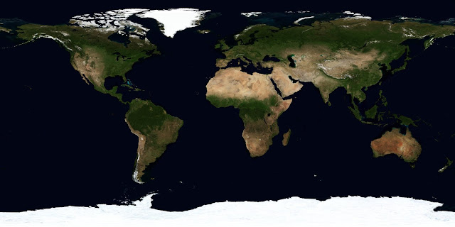
There is quite a lot of evidence to support the theory of continental drift. If you have noticed, the different continents are like pieces of a jigsaw puzzle that can be put together to give the picture of one huge land mass. Just look at the shapes of Africa, and South America on a map, and you can see this for yourself.
Another point is that plant and animal fossils of the same age and similar species are found on the shores of different continents. This suggests that they were once joined. There is also living evidence, like the same unusual animals being found on different continents that are far apart. This provides further proof that Wegener was right in his theory !!!


No comments:
Post a Comment